

Give us back our access to the sea (Sutorinu) Bosnia and Herzegovina!
As a citizen of Bosnia and Herzegovina, I want to invite all aware and proud patriots to attend the signing of the petition in order to preserve the integrity and sovereignty of our country of Bosnia and Herzegovina.
We ask that proposals and decisions on signing international borders, where Sutorina compositions in CG, with the neighboring country of Montenegro stopped so as not to cause prejudice to the territorial integrity of Bosnia and Herzegovina.
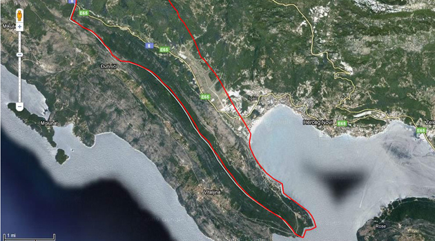
Sutorina has always been a part of modern Bosnia and Herzegovina, as well as her second exit to the sea, near the town of Neum. Sutorina is a piece of land of about 75 square kilometers, and the length of the coastline of some 5-7 km. This is confirmed by many maps and written records. It was not until 1948, appearing first maps that Sutorinu drawn within Montenegro after informal conversation Duro Pucara old with Montenegrin politician Blaz Jovanovic.
Proving that Sutorina part of Bosnia and Herzegovina used different arguments and referred to different years, since 1878 and the Congress of Berlin, until 1936, when he allegedly this area 'transcribed' Montenegro. Map of 1946 (Year of publication: 1946 Publisher; state publishing Bosnia and Herzegovina, Sarajevo Printing: Lithography "Božankovski" Zagreb) testified that the Sutorina after the end of World War II was part of BiH.
- 8 Nov, 2014
- 2194 views
- 1 comment